Monsoon Spreads Across South and East India as IMD Tracks Advance
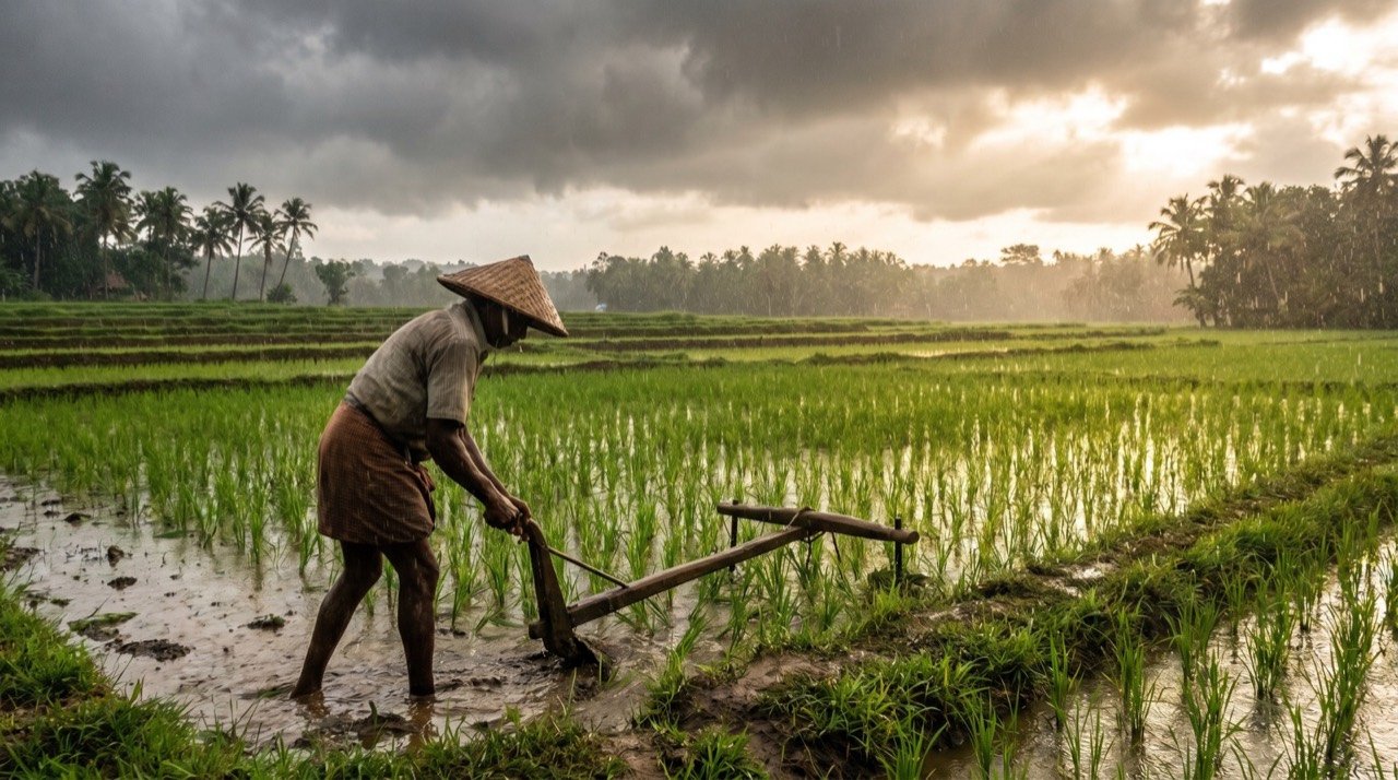
The southwest monsoon, which arrived early over Kerala in late May, has advanced across much of southern and eastern India through early-to-mid June, though cumulative June rainfall has run below normal.
The NE Times National Desk
Commentary & Analysis ·
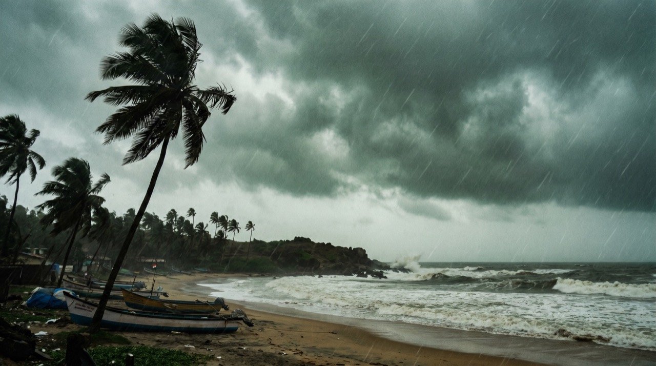
The southwest monsoon, which arrived early over Kerala in late May, has advanced across much of southern and eastern India through early-to-mid June, though cumulative June rainfall has run below normal. The India Meteorological Department says the system has steadily moved north and east since the start of June, covering Goa and parts of Karnataka, Maharashtra, Andhra Pradesh and Tamil Nadu by June 6.
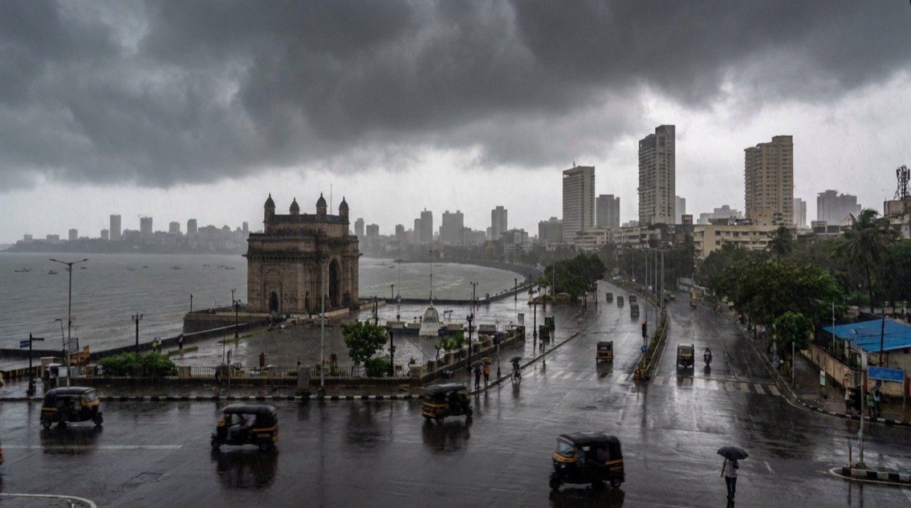
The monsoon is the single most important weather event in the Indian calendar, supplying the bulk of the country's annual rainfall and shaping everything from farm output to reservoir levels and power demand. Its onset, pace and spread are watched closely because so much of the economy, particularly agriculture, is keyed to its timing.
Tracking the advance
By June 9 the system had reached the remaining northeastern states, all of Sikkim and parts of sub-Himalayan West Bengal, and by June 12 it had pushed further into West Bengal and Bihar. The IMD tracks this progress by drawing a moving boundary, the monsoon's leading edge, across the map as the rain-bearing winds sweep inland from the seas on either side of the peninsula.
An early arrival over Kerala, as happened this year, is generally welcomed, but the headline date masks an uneven journey. The pace at which the monsoon then fans out across the rest of the country can vary widely, and the early weeks of June showed that mixed picture.
Rainfall still below normal
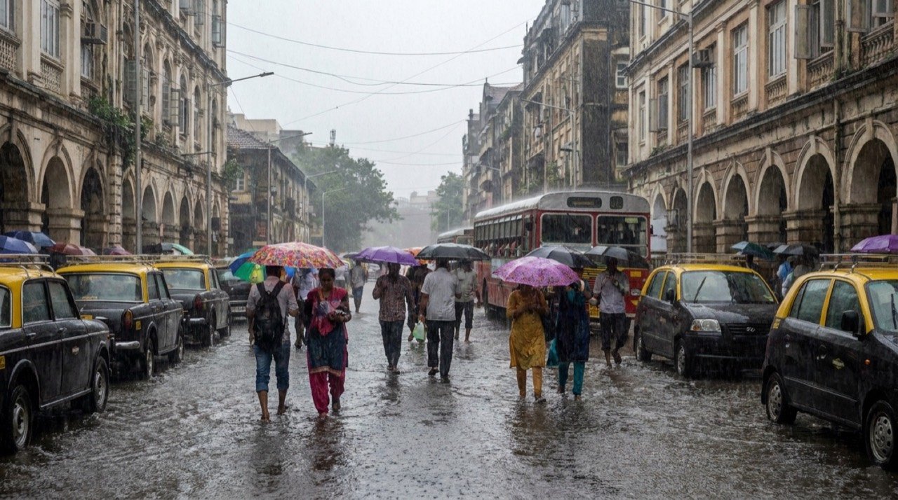
Despite the advance, cumulative rainfall between June 1 and June 10 was about 26 percent below normal, underlining the uneven early progress of the season. A deficit this early does not by itself determine how the full season will turn out, since the monsoon often makes up ground in later weeks, but it does shape sowing decisions and water management in the short term.
For farmers preparing for the kharif planting season, the timing and distribution of these early showers matter as much as the totals. Patchy rain can delay sowing in some districts even as others receive enough to begin, leaving an uneven start across the country.
The week ahead
Forecasters expect isolated heavy to very heavy rain over sub-Himalayan West Bengal and Sikkim, with a wet spell continuing over parts of northwest India under the influence of a western disturbance. A western disturbance is a weather system that moves in from the west and can bring rain to northern India, and when it interacts with the advancing monsoon flow the result can be locally intense downpours.
Heavy rain over hilly northeastern and sub-Himalayan terrain also raises the usual seasonal concerns about waterlogging, landslides and swollen rivers, which authorities monitor closely once the monsoon takes hold.
Outlook
With the monsoon having covered large parts of the south and east and now pressing into the eastern plains, attention shifts to whether the system can close the early rainfall gap as it advances toward central and northwest India. The coming weeks of the season will determine whether the strong onset translates into the steady, well-distributed rain that the country's farms and reservoirs depend on.
The NE Times View
An early onset that has not translated into adequate rainfall is the worst of both worlds for planners. Below-normal June totals strain sowing decisions, reservoir levels and power demand just as the heat lingers. The monsoon's headline arrival matters far less than its distribution, and farmers will judge this season by what falls in July, not by the calendar.
This article is original commentary and analysis by The NE Times. Background facts were referenced from the India Meteorological Department and Herald Goa.
You may also like to read
Monsoon Advances Toward Mumbai and Eastern India as Rain Alerts Issued
The southwest monsoon has resumed its march after a brief pause, with weather agencies forecasting widespread and locally heavy rain across Mumbai, Maharashtra, eastern and central India.
IMD Confirms Southwest Monsoon Onset Over Mumbai After Delayed Spell
The India Meteorological Department has confirmed the Southwest Monsoon's arrival over Mumbai on June 23, bringing relief after a dry, unusually warm early June and pushing the city into full monsoon readiness.
Monsoon advances across the country in June, but IMD warns of a below-normal season
After reaching Kerala on 4 June, the southwest monsoon has spread into eastern and central India, even as the weather office trims its seasonal rainfall forecast to 90% of the long-period average.
Early, Intense Monsoon Swamps Cities As Mumbai And Gujarat Bear The Brunt
An early and unusually intense monsoon has triggered urban flooding across western India, with Mumbai, Gujarat and Goa recording exceptional rainfall as drainage systems strain under the deluge.
More from this section
More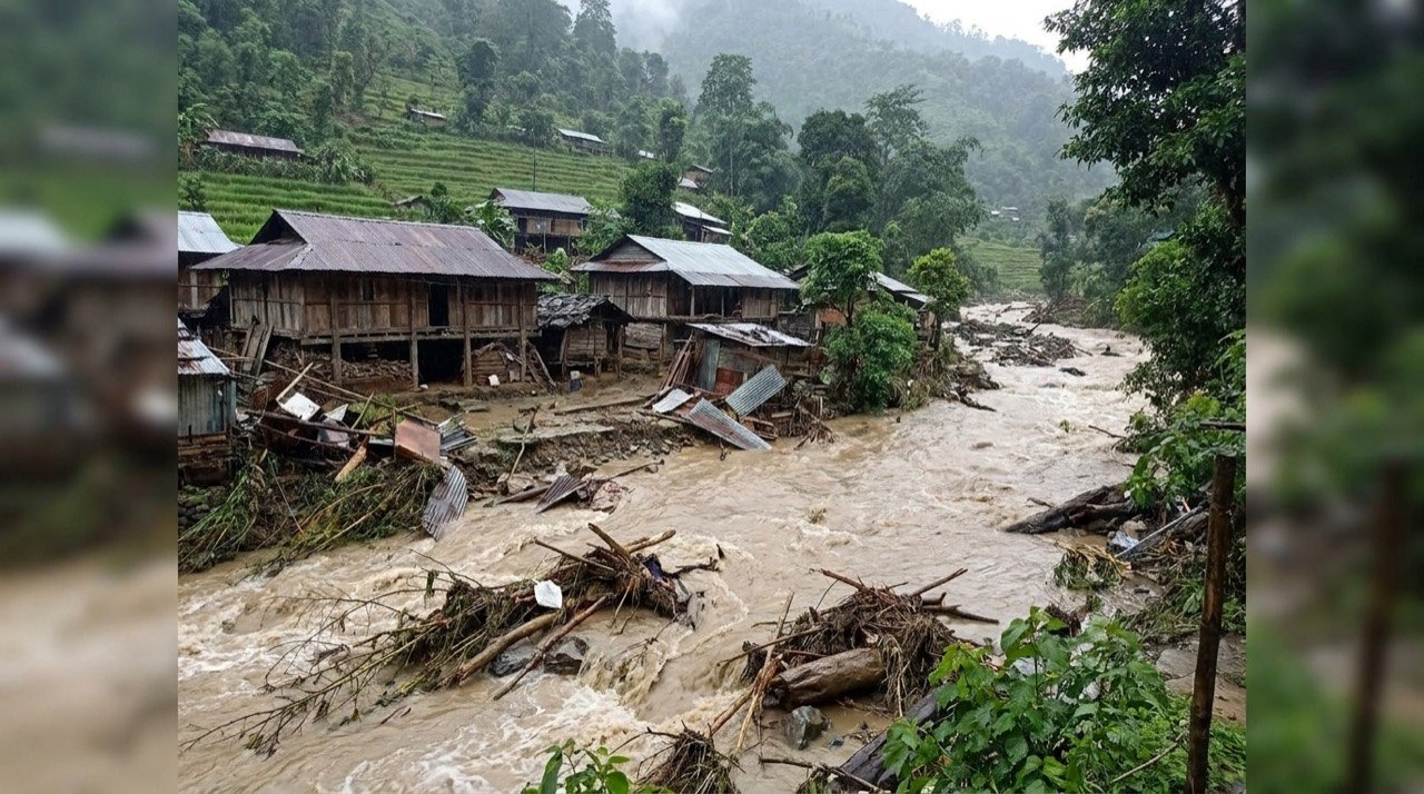
Arunachal Flash Flood Sweeps NEEPCO Colony in Keyi Panyor, One Dead and Four Missing
A pre-dawn cloudburst-like spell on 24 June triggered flash floods and landslides that swept away semi-permanent homes near a hydel project in Arunachal Pradesh, killing one and leaving four missing.
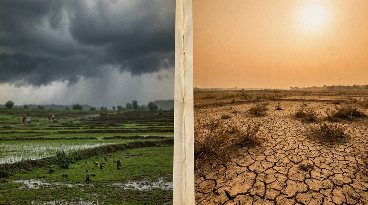
Monsoon Surges Into Central India as Heatwave Grips the East: A Split Weather Map
The India Meteorological Department reported the monsoon advancing into Gujarat and central India on 24 June even as severe heat scorched the east, leaving the country under a sharply divided weather pattern.
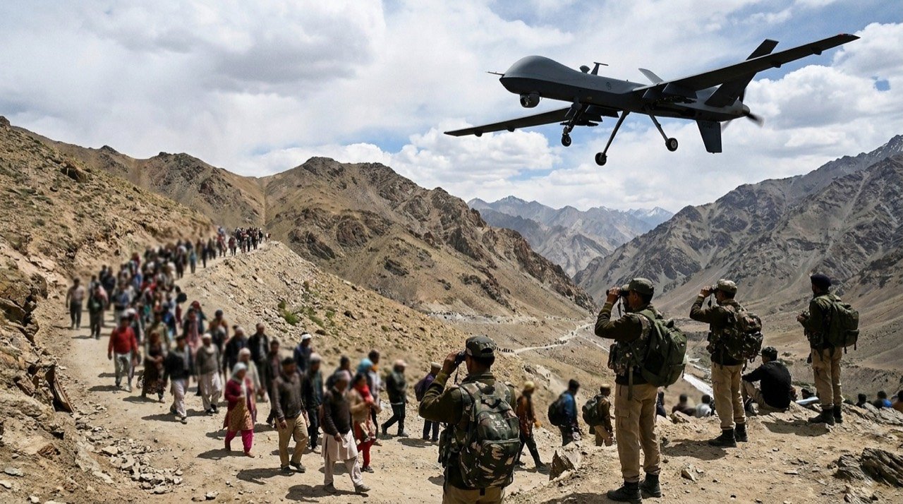
Project Hawk Eye: AI, Drones and Snipers to Guard the Amarnath Yatra
Anantnag police have unveiled Project Hawk Eye, a layered surveillance net of drones, facial recognition, hundreds of CCTV cameras and sniper teams to secure the 2026 Amarnath Yatra beginning 3 July.